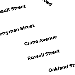
12 SO BREAULT STREET
Owner Information
DUPUIS MATTHEW
12 SO BREAULT STREET
WESTPORT, MA 02790


Property Details
12 SO BREAULT STREET is classified as a Single Family Residential (Bungalow).
The primary structure on this property was built in 1920. There are 960ft2 of built area within this property. There is 960ft2 of residential/living space within this property.
12 SO BREAULT STREET is valued at $214,100. The land is valued at $114,200 and the structures are valued at $87,800. There is an additional valuation of $12,100 on this property.
The most recent deed for 12 SO BREAULT STREET is recorded at the local registrar in Book 10503, Page 24-25. 12 SO BREAULT STREET was last sold on Tuesday, September 4, 2012 for $120,000.
Assessment data from fiscal year 2022.
Flood Data
According to the FEMA National Flood Hazard Layer, this property does not appear to be in a flood zone. It may also be in an area not yet reviewed. Nonetheless, confirm this information prior to taking any action.
To view the flood hazards around this property, create a FEMA "Firmette" Map of the area around 12 SO BREAULT STREET.
Broadband Internet Providers
| Provider | Type | Bandwidth (mbps) | |
|---|---|---|---|
| HughesNet | Satellite | 25 | 3 |
| Charter Communications Inc | Cable | 940 | 35 |
| T-Mobile | Fixed Wireless | 25 | 3 |
| GCI Communication Corp. | Satellite | 0 | 0 |
| Verizon New England Inc. | DSL | 5 | 0 |
| Viasat Inc | Satellite | 100 | 3 |
| VSAT Systems, LLC. | Satellite | 2 | 1 |
Broadband service provider data from December 2020.
Adjacent Properties
- 0 BERRYMAN STREET
Undevelopable Residential Land owned by FREELOVE JODY S & - 16 SO BREAULT STREET
Undevelopable Residential Land owned by PACHECO KENNETH A & JEANNINE E - 8 SO BREAULT STREET
Single Family Residential owned by BALDWIN HAROLD & DEBORAH L TRS - 15 SO BERRYMAN STREET
Single Family Residential owned by NUNES RICHARD D & DIANE J